


Caribbean meadow katydid
Conocephalus cinereus
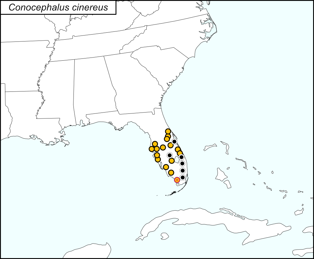

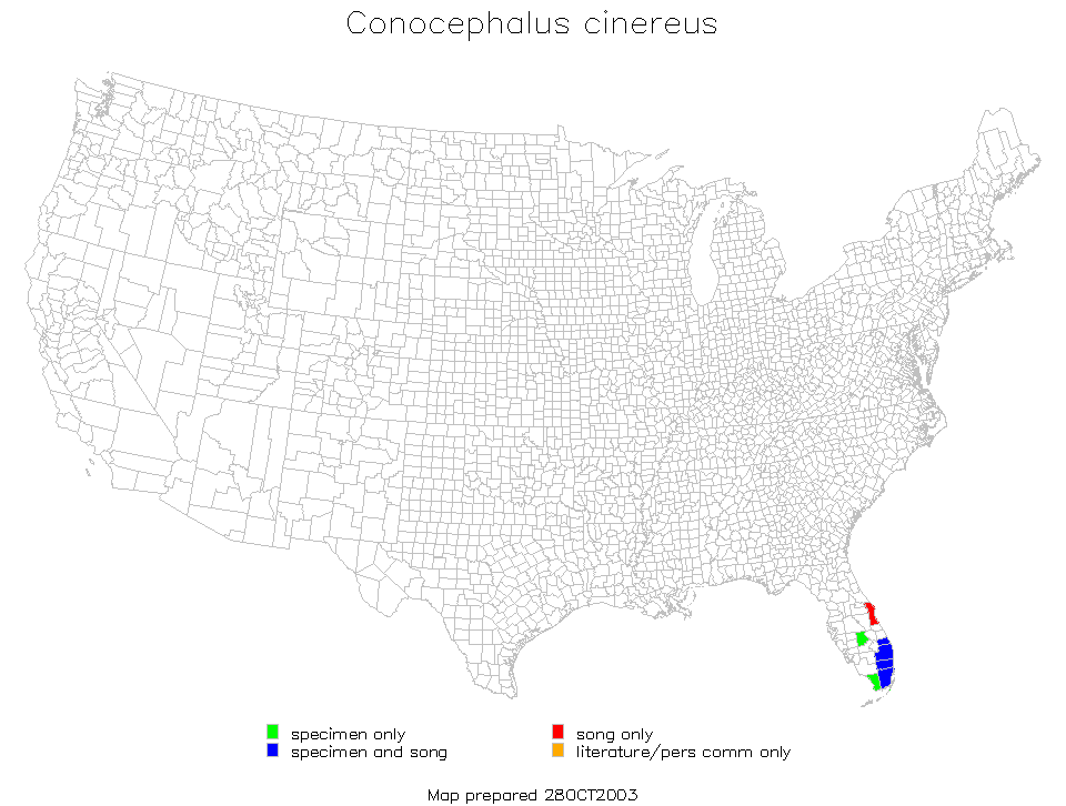
All dots on the distribution map represent county records. The black dots  are records from tblMain. Gold dots
  and the red and gold target dot
  on the distribution map represent records from iNaturalist; the red and gold target dot is placed on Monroe County, which is shown in greater detail in the map below.
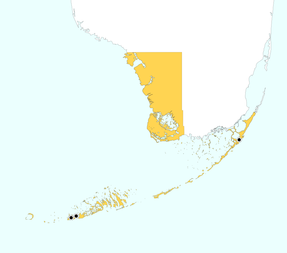
Monroe County, Florida includes the southwest portion of the tip of mainland Florida and the Upper and Lower Keys. On the distribution map, a single red and gold target dot is placed at the center of the mainland portion of Monroe county. The above map shows the boundaries for Monroe County, highlighted in GOLD, and the localities for Monroe County from tblMain: Key Largo, Stock Island, and Key West.
Summary of Species' SINA Distribution*
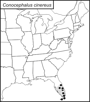
Conocephalus cinereus is found in Central and South Florida.
*North America, north of Mexico.
List of United States Regions, States, and Counties
Map of
United States
Regions
Map of United States Regions
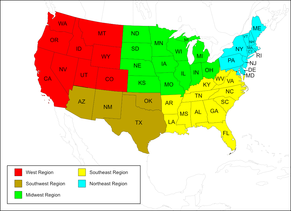
Southeast Region
State: Florida
Records from tblMain
Counties: Brevard, Broward, Highlands, Martin, Miami-Dade, Monroe, Palm Beach.
Records from iNaturalist
Counties: Broward, Collier, Glades, Hillsborough, Indian River, Lee, Manatee, Orange, Osceola, Pasco, Pinellas, Sarasota, Seminole, St. Lucie, Volusia.
Notes
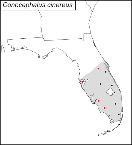
References: tblMain Second dot map Original dot map Computer-generated map
The distribution map on this page is referred to as the 2024 distribution map.
Monroe County map was updated with new Monroe County map of higher resolution. [tmy 21 April 2025]
The computer-generated map, original dot map, and tblMain records are in agreement. On the computer-generated map, the record for Monroe County is on the mainland; on the original dot map, the locations in Monroe County (Key Largo, Key West, Stock Island, and Florida Keys) are represented by 2 dots, one on the Upper Keys and one on the Lower Keys. The second dot map, created in September 2020, included 5 new records from iNatualist: Collier, Hillsborough, Lee, Orange, and Pinellas counties. In creating the 2024 distribution map, the following records, also from iNaturalist, were added: Broward, Glades, Indian River, Manatee, Osceola, Pasco, Sarasota, Seminole, St. Lucie, and Volusia.
On tblMain there are also records for Rio Piedras, Puerto Rico and Tamaulipas, Vera Cruz, and Colima Mexico. [tmy 23 March 2025]