


saltmarsh meadow katydid
Conocephalus spartinae
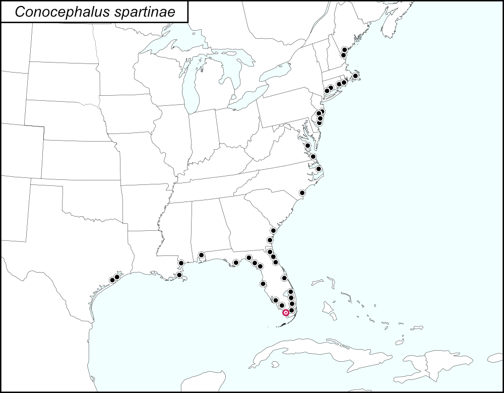

The black dots  on the distribution map represent county records from tblMain. The red target dot
  is placed on Monroe County, which is shown in greater detail in the map below.
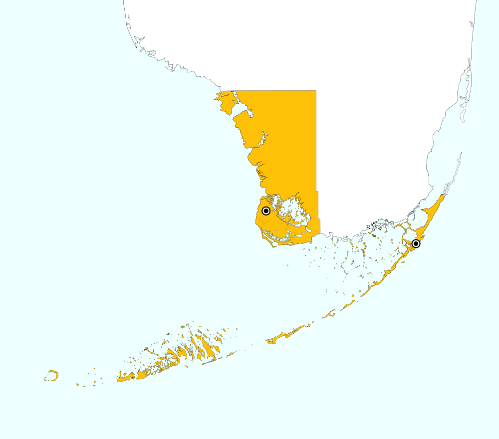
Monroe County, Florida includes the southwest portion of the tip of mainland Florida and the Upper and Lower Keys. On the distribution map, a single red target dot is placed at the center of the mainland portion of Monroe county. The above map shows the boundaries for Monroe County, highlighted in GOLD, and the localities for Monroe County from tblMain: Cape Sable and Key Largo.
Summary of Species' SINA Distribution*
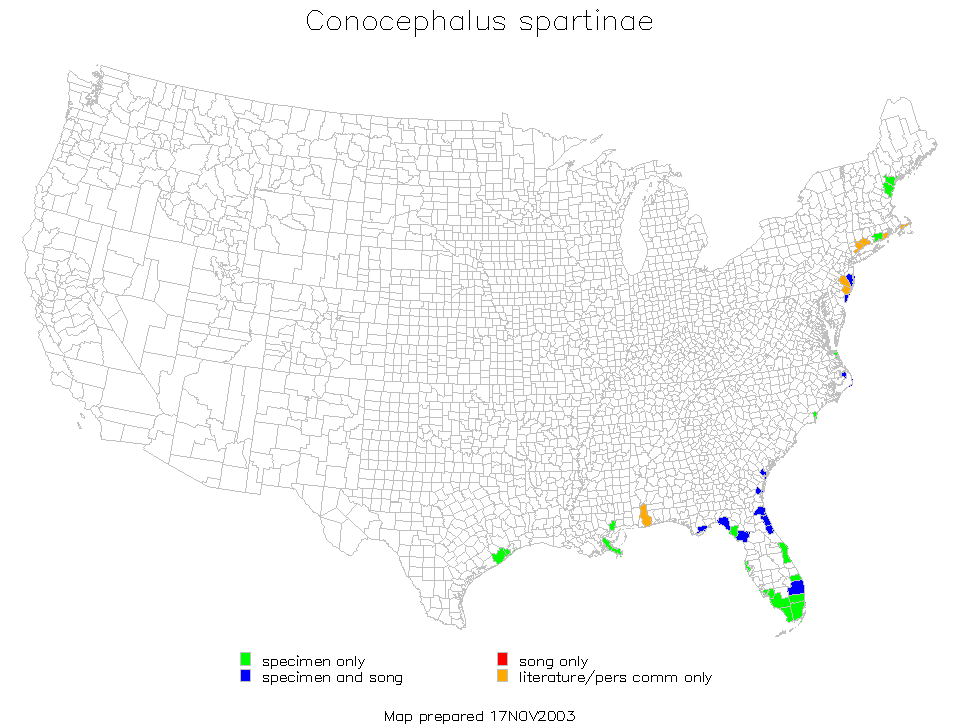
Conocephalus spartinae is found along the eastern coast of the United States from Maine to south Florida and along the Gulf Coast from south Florida to Texas.
*North America, north of Mexico.
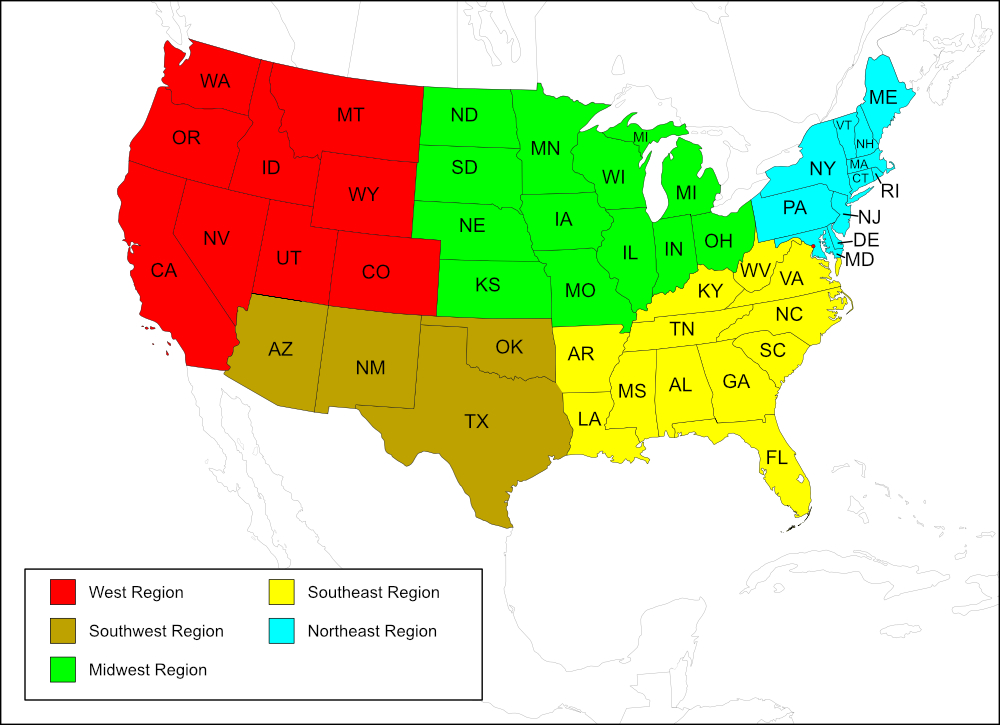
List of United States Regions, States, and Counties
Map of
United States
Regions
Map of United States Regions
Southwest Region
State: Texas
Counties: Brazoria, Galveston.
Region
State: Alabama
Counties: Baldwin
State: Florida
Counties: Brevard, Broward, Collier, Dixie, Duval, Flagler, Franklin, Lee, Levy, Martin, Miami-Dade, Monroe, Palm Beach, Pinellas, St. Johns, Taylor.
State: Georgia
Counties: Chatham, Glynn.
State: Louisiana
Counties: Plaquemines.
State: Mississippi
Counties: Hancock.
State: North Carolina
Counties: Dare, New Hanover.
State: Virginia
Counties: Lancaster, Virginia Beach (independent city).
Region
State: Connecticut
Counties: Fairfield, New Haven, New London.
State: Massachusetts
Counties: Barnstable.
State: Maine
Counties: Cumberland, York.
State: New Jersey
Counties: Atlantic, Burlington, Cape May, Ocean.
State: Rhode Island
Counties: Washington.
Notes
References:
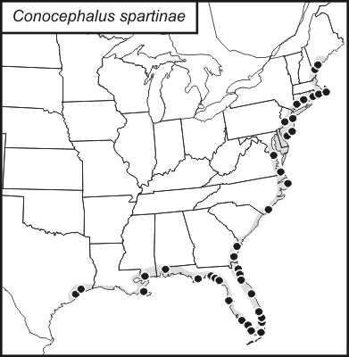
The distribution map on this page is referred to as the 2024 distribution map.
The records for this species are from tblMain and are in agreement with the original dot map. Lancaster County, Virginia is not apparent on the computer-generated map; it is uncertain if the record was not added to the computer-generated map or if the resolution was too low for the color marking the county to be seen. [tmy 22 April 2025]
The species number given for Conocephalus spartinae in tblMain is 237.This species number is used for the file names for the computer-generated map (237mc.gif) and the Excel worksheet and chart (237gd.xls). All other files and images on SINA use 235. There are no other species in tblMain with the species number 235. All numbers were left as they are.