


superb meadow katydid
Orchelimum superbum
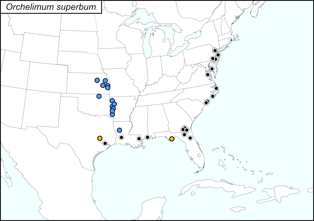

All dots on the distribution map represent county records. The black dots  are records from tblMain. The blue dots
  are from Cole and Chatfield-Taylor (2012). The gold dots
  represent records based on observations from iNaturalist.
Summary of Species' SINA Distribution*
Orchelimum superbum is found in the Midwest (Kansas), Southwest (Oklahoma and Texas), Southeast (Arkansas, Florida, Georgia, Louisiana, Mississippi, North Carolina, and Virginia), and Northeast (Maryland, New Jersey, and Pennsylvania) Regions of the United States.
*North America, north of Mexico.
List of United States Regions, States, and Counties
Map of
United States
Regions
Map of United States Regions
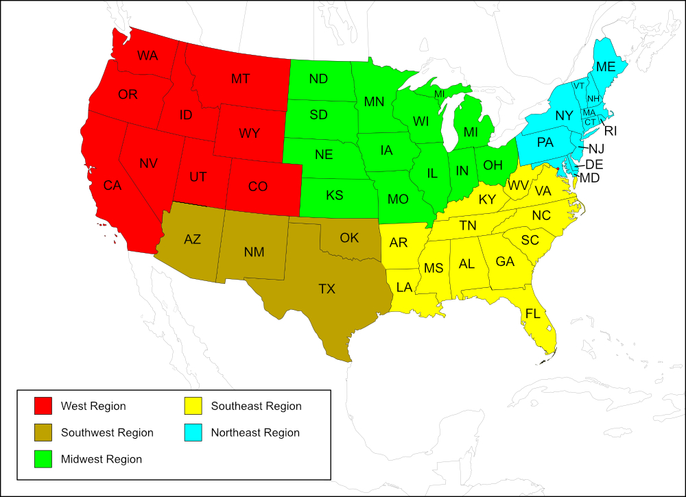
Midwest Region
State: Kansas
Records from Cole and Chatfield-Taylor (2012)
Counties: Bourbon, Coffey, Douglas, Geary, Linn.
Southwest Region
State: Oklahoma
Records from Cole and Chatfield-Taylor (2012)
Counties: Osage.
State: Texas
Records from tblMain
Counties: Harris.
Records from iNaturalist
Counties: Brazos.
Southeast Region
State: Arkansas
Records from Cole and Chatfield-Taylor (2012)
Counties: Franklin, Polk, Scott, Sebastian, Sevier, Washington.
State: Florida
Records from tblMain
Counties: Columbia, Putnam.
Records from iNaturalist
Counties: Franklin.
State: Georgia
Records from tblMain
Counties: Charlton, Clinch, Ware.
State: Louisiana
Records from tblMain
Parishes: Allen, St. Tamamany.
Records from Cole and Chatfield-Taylor (2012)
Parishes: Natchitoches.
State: Mississippi
Records from tblMain
Counties: Jackson.
State: North Carolina
Records from tblMain
Counties: Brunswick, Carteret, Dare, New Hanover.
State: Virginia
Records from tblMain
Counties: Essex.
Northeast Region
State: Maryland
Records from tblMain
Counties: Dorchester.
State: New Jersey
Records from tblMain
Counties: Camden, Gloucester, Monmouth, Morris.
State: Pennsylvania
Records from tblMain
Counties: Delaware.
Notes
References:
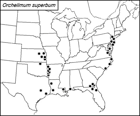
The distribution map on this page is referred to as the 2024 distribution map.
The records from tblMain are in agreement with the computer-generated map. The 2020 dot map was created in 2020 to add the records from Cole and Chatfield-Taylor (2012); on both this map and the original dot map, there is only one dot for Brunswick and New Hanover counties in North Carolina (records from tblMain). Records from iNaturalist are from Research Grade observations that were uploaded from 19 April 2019 to 26 June 2024. [tmy 13 May 2025]