


great grig
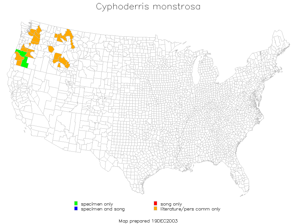
Cyphoderris monstrosa
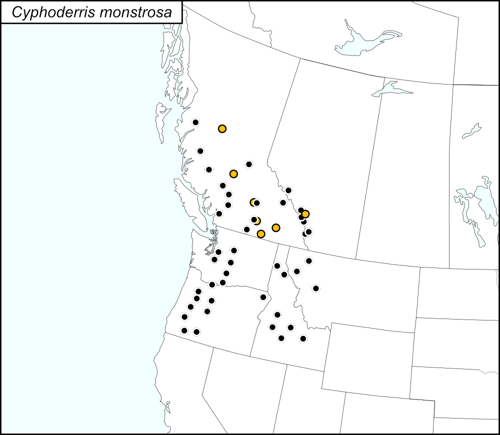

All dots on the distribution map represent county records. The black dots  are records from tblMain. Blue dots
  represent Regional Districts in British Columbia and a Census Division in Alberta, records derived from localities listed in tblMain.
Summary of Species' Distribution in North America north of Mexico
Cyphoderris monstrosa ranges in the Southwest Region of the United States (Washington, Oregon, Idaho, and Montana) and in British Columbia and Alberta, Canada.
List of United States Regions, States, and Counties
Map of
United States
Regions
Map of United States Regions
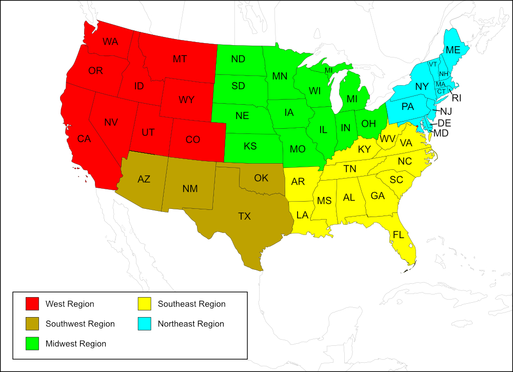
West Region
State: Idaho
Counties: Boise, Butte, Camas, Custer, Kootenai, Shoshone, Valley.
State: Montana
Counties: Flathead, Powell, Sanders.
State: Oregon
Counties: Deschutes, Douglas, Hood River, Jackson, Jefferson, Klamath, Lane, Linn, Marion, Wallowa.
State: Washington
Counties: Chelan, King, Kittitas, Klickitat, Pierce, Yakima.
List of Canadian Provinces, Regions, and Localities
Map of
Canadian
Provinces
Map of Canadian Provinces
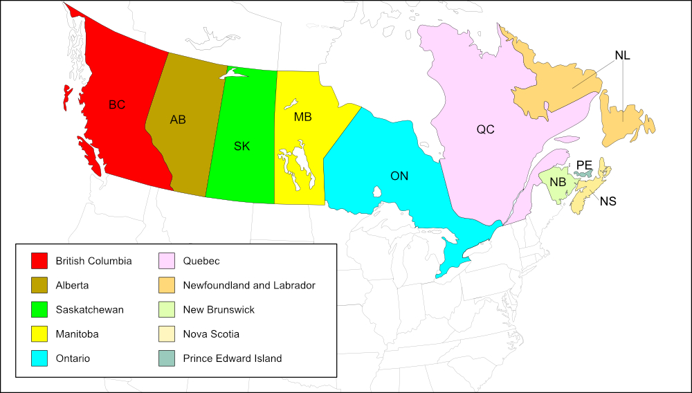
British Columbia
Regional District: Bulkley-Nechaka
Localities: Smithers (town).
Regional District: Cariboo
Localities: Chilcotin (geographic region).
Regional District: Central Kootenay
Localities: Ainsworth (Hot Springs; community).
Regional District: Central Okanagan
Localities: Peachland (district municipality).
Regional District: Thompson-Nicola
Localities: Clinton (village).
Alberta
Census Division #15: Canmore
Localities: Banff (town), Saskatchewan River, below junction of North Fork.
Notes
References:
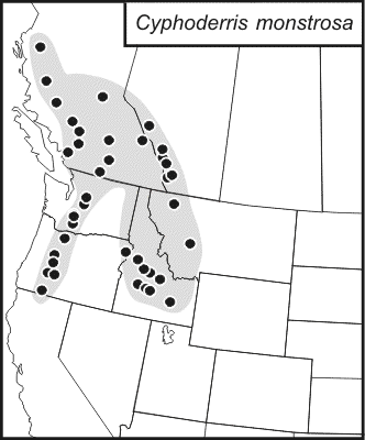
The distribution map on this page is referred to as the 2024 distribution map.
All records are from tblMain.
Idaho Panhandle: tblMain and the computer-generated map include the counties Kootenai and Shoshone; these counties are not on the original dot map. Dots have been added for Kootenai and Shoshone counties to the 2024 distribution map.
Southern Idaho: The original dot map has 8 dots, tblMain only has 5 counties listed (Boise, Butte, Camas, Custer, Valley). The extra dots are likely in reference to localities in Boise County (Centerville and Idaho City) or Custer County (Shallis, Bull Trout Lake, Red Fish Lake). Butte and Valley counties only list 1 locality each (Arco and McCall, respectively). Camas County has only one entry but no locality is given. Counties on the computer-generated map are in agreement with those listed in tblMain. For the 2024 distribution map, dots were only added for Boise, Butte, Camas, Custer, and Valley counties.
Montana: The original dot map has 2 dots, the computer-generated map shows 3 counties, which is consistent with those listed on tblMain. The county missing on the original dot map is Sanders. A dot for Sanders County was added to the 2024 distribution map.
Oregon: The original dot map has 7 dots and tblMain lists 9 counties, in agreement with the computer-generated map. The counties that are not on the original dot map but are in tblMain are Jefferson and either Klamath or Jackson. All counties listed in tblMain and shown on the computer-generated map were added to the 2024 distribution map.
Washington: The original dot map has 4 dots. The computer-generated map and tblMain have 6 county records. The 2 counties missing on the original dot map are King and Pierce. All 6 counties listed in tblMain and shown on the computer-generated map were added to the 2024 distribution map.
British Columbia and Alberta: tblMain gives 5 records for localities in Alberta (Ainsworth, Banff, Peachland, Saskatchewan River, below junction of North Fork, and Smithers) and 2 localities for British Columbia (Chilcotin and Clinton). Ainsworth, Peachland, and Smithers are located in British Columbia, making 5 records for British Columbia and 2 records for Alberta in tblMain. The locality Saskatchewan River, below junction of North Fork is likely in Alberta because the Saskatchewan River is not in British Columbia and there are no records for Saskatchewan or Manitoba. I placed this locality on the 2024 distribution map in Census Division #15, Canmore, because all of the dots on the original dot map are in that Census Division.
The original dot map has 12 dots in British Columbia and 6 dots in Alberta. The original dot map was superimposed over the 2024 distribution map to locate the positions for the black dots . I added blue dots at the centers of the Regional Districts in British Columbia and the Census Division in Alberta.
The computer-generated map does not extend to Canada and therefore offers no clues to understanding Canadian records. [tmy 11 November 2024]