

|

|
| 1970 | 2018 |
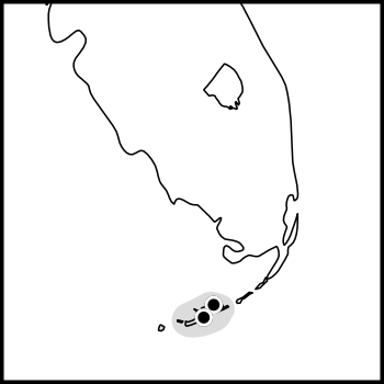
The map on the left shows the distribution of records of A. celerinictus in south Florida and the keys as of 1970. Solid dots indicate specimen records with song. Detailed data are as follows: 11 Jun 1970, two males, captured and recorded, one on Big Pine Key and the other on a key ca. 11 miles toward Key West; 24 Jun 1970, one male heard on Big Pine Key. The shaded area on this map shows the expected distribution as of 1970.
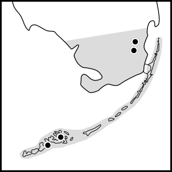
The shaded area of the map at right shows the probable distribution of A. celerinictus in Florida in 2018. The dots show the positions of south Miami and Homestead (both in Dade County). Brandon Woo’s field notes substantiating these records of A. celerinictus in south Florida are shown below.
Woo’s field notes as copied from his email of 31 Aug 2021:
1 male, FL: Miami-Dade Co: Miami, Marathon gas station: 25.566, -80.428778; 15 July 2018; B. Woo
1 male, FL: Miami-Dade Co: Homestead, Hampton Inn: 25.478111, -80.435306; 15 July 2018; B. Woo
5 males, FL: Miami-Dade Co: Patch of Heaven Sanctuary: 25.562537, -80.449203; 06 August 2021; B. Woo, H. Song

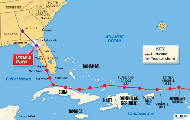
Hurricane Irma (2017) was the first Category 5 storm known to have struck the Leeward Islands. It did not stop there but proceeded westward toward the north coast of Cuba. Once arriving there at a point directly north of Jamaica (which is some 90 miles south of Cuba), the eye of the storm bounced along the north coast of Cuba until it almost reached a point directly south of Key West. From that point in Cuba it crossed the Gulf of Mexica and struck Key West as a Category 4 storm. It maintained much of its strength as it proceeded up the west coast of Florida. (Source: NOAA. Distance between the red dots represent 12 hours.)

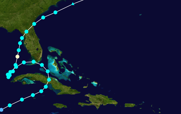
Hurricane Eta originated from a strong tropical wave in late October 2020. It wandered in the eastern Caribbean Sea until it became a Category 4 hurricane on October 31. It weakened as it passed over Nicaragua but regained strength when it reached open water as it accelerated toward Cuba. On November 8 it made landfall in Cuba and became a tropical storm before exiting that island and touching southmost peninsular Florida. The system had adequate time to pick up living material on the north coast of Cuba and deliver it to similar habitats in south Florida. (Image downloaded from Wikipedia; author FleurDeOdile. The points show the location of the storm at 6-hour intervals.)
Neither of the storms shown above are typical of previous weather records. In fact, each is unprecedented! Some of what has happened is a result of warmer waters in the Caribbean. This and other changes in the area may result in changes that are much more extensive in their effects. Consider, for example, the effect of the Gulf Stream slowing or stopping!